Recreating Switzerland 1:1: A Hardcore Open-Source Brick Map Project

A voxel map project rebuilding Switzerland block by block at true 1:1 scale has sparked heated discussion in the technical community.
A project called "Switzerland. Block by block. At 1:1 scale" earned 233 points and nearly a hundred comments on Hacker News. It voxelizes Switzerland's terrain, buildings, and landscape into uniform blocks assembled at true 1:1 scale, likely relying on the open-source Manifold 3D geometry library for manifoldness and stability in massive boolean operations. The article analyzes the threefold challenge of data cleaning, geometric continuity, and browser rendering performance, notes that brick-style expression makes terrain and urban density countable and comparable, and offers an intermediate expression approach between BIM and schematics for digital twins and urban planning visualization.
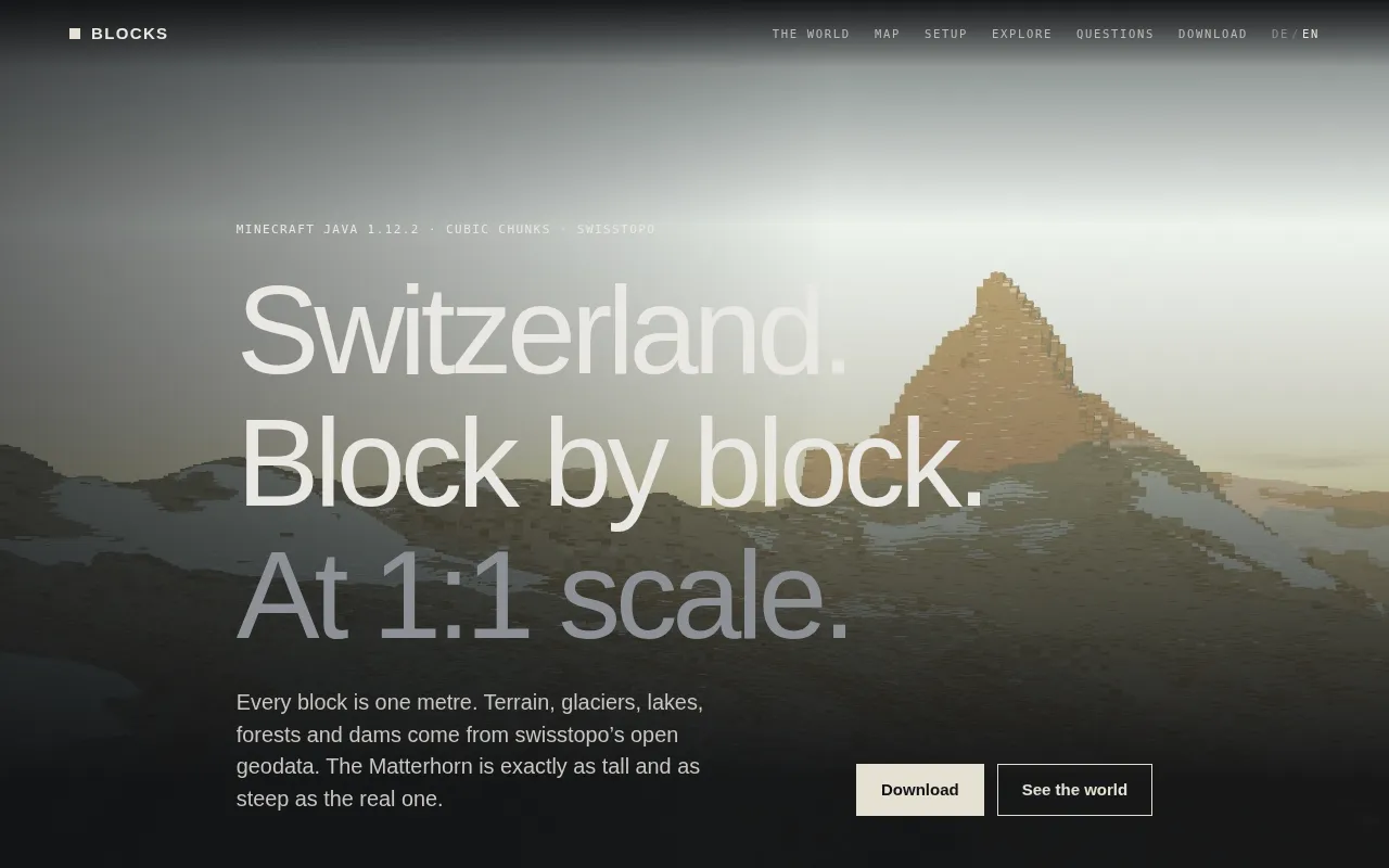
A project called "Switzerland. Block by block. At 1:1 scale" has sparked widespread discussion on Hacker News, earning 233 points and nearly a hundred comments. The core idea is almost clumsily simple: rebuild the entire country of Switzerland at true 1:1 scale using modular, LEGO-like blocks.
What the project actually is
Judging from the project URL blocks.manifold3d.ch and the discussion, this isn't a traditional geographic information display but a voxelized map of Switzerland built on a 3D geometry engine. "Block by block" means breaking the terrain, buildings, and landscape into uniform cube units and assembling them one by one according to real-world coordinates.
"1:1 scale" is the key qualifier. It means the model isn't artistically scaled down—each block corresponds to a real-world spatial unit, so users see not an abstract schematic but a highly faithful spatial structure. This scale choice sends data density and rendering pressure up exponentially, which explains why the project caught the technical community's attention.
The manifold3d in the domain suggests the project relies on Manifold, an open-source 3D geometry library, under the hood. Manifold is known for handling complex boolean operations and guaranteeing geometric manifoldness, making it well suited to stable merging and clipping of massive numbers of blocks—precisely the technical prerequisite for building a large-scale voxel map.
Voxel is a portmanteau of volume and pixel, referring to a cubic unit on a regular grid in 3D space—essentially a 2D pixel extended into three dimensions. In a voxel representation, continuous surfaces or solids are discretized into a set of equal-sized cubes, each recording whether it is occupied along with attributes like material and color. The advantage of voxel models is their uniform structure, which facilitates boolean operations and merging and naturally supports spatial indexing and level-of-detail (LOD) optimization; the cost is that storage and the number of geometric objects grow cubically with resolution and coverage area. For a map covering an entire country at 1:1, even if a single block corresponds to a scale of several meters, the total number of blocks can reach tens of millions or even hundreds of millions, so efficient geometric merging and rendering culling strategies are essential.
Manifold is a core concept in topology and geometric modeling: a geometric body is called a 2-manifold if, near every point on its surface, it is locally homeomorphic to a plane (i.e., there are no self-intersections, non-manifold edges, or zero-thickness faces). In 3D printing and boolean modeling, non-manifold geometry causes slicing failures, broken rendering surfaces, or crashes in subsequent operations. Boolean operations refer to set operations such as union, intersection, and difference on two solids, and are the fundamental operations for voxel assembly and terrain clipping. The Manifold library uses exact predicate computation and robust topology maintenance to guarantee that the output of boolean operations always remains manifold, so the results of large-scale block merging can be used directly for rendering or further processing without manual repair of broken faces afterward.
Why a 1:1 brick map is worth attention
The dual challenge of data and geometry
Breaking an entire country into blocks means the number of geometric objects reaches an astonishing magnitude. Even covering only major cities and terrain, the total block count far exceeds that of an ordinary 3D scene. The project must solve problems at three levels: first, cleaning and aligning the source data; second, geometric continuity during voxelization; and finally, real-time rendering performance in the browser.
This is exactly where libraries like Manifold prove their worth. In traditional 3D modeling, merging large numbers of overlapping blocks easily produces non-manifold edges and zero-thickness faces, leading to broken rendering surfaces or failures in subsequent processing. By guaranteeing the manifoldness of output geometry, Manifold keeps brick-style assembly manageable even in large-scale scenes.
Rendering culling is a key technique for handling large-scale scenes in the browser. Common strategies include frustum culling (skipping objects outside the view), occlusion culling (skipping objects fully hidden by foreground objects), and level of detail (LOD, substituting lower-precision models for high-precision ones at a distance). For voxel maps, adjacent blocks of the same material can also be merged into larger meshes (mesh merging), compressing thousands of individual draw calls into a few batches and significantly reducing GPU overhead. In addition, tile-based streaming loading lets users download only the data chunks near their current view—a practical prerequisite for an interactive 1:1 nationwide map on the web. These optimizations work in tandem with the geometry library's manifold guarantees to form a complete pipeline from data to an interactive scene.
An explorable way of narrating geography
Compared with static maps or generic 3D globes, brick-style processing offers a new way of seeing. The discreteness of blocks makes terrain relief, urban density, and building outlines countable and comparable. As users browse, they can intuitively sense the spatial difference between mountains and plains rather than having it masked by smooth textures. This form of expression has unique advantages in education and visual communication.
The buzz in the Hacker News comments also shows that the technical community has sustained interest in projects that "reproduce the physical world through engineering." It is both a test of the usability of geographic data and a public stress test of the open-source graphics toolchain.
The open-source signals behind the tech stack
Publicly available information about the project is limited, but the domain and the project's positioning reveal a few signals.
On one hand, choosing an open-source geometry kernel like Manifold suggests the author values geometric robustness over off-the-shelf game engine solutions. Game engines excel at rendering but are not built for large-scale voxel boolean operations; geometry libraries excel at precision but require building the rendering pipeline yourself. This is a trade-off that leans toward "engineering correctness."
On the other hand, the 1:1 scale means the project is inherently tied to real geographic coordinates. If a data interface is opened later or users are allowed to overlay their own data, it could evolve into an extensible national-scale spatial data experimentation platform rather than just a display page.
It is currently unclear what the project's complete data sources and block granularity are, and public discussion includes differing views on data licensing, precision boundaries, and loading performance. These disagreements themselves show that large-scale voxel geography projects still need to balance fidelity against usability when implemented.
What developers can learn
The value of such projects goes beyond looking good. It demonstrates several reusable ideas: using discrete units to lower the barrier to understanding complex scenes; using manifold geometry to ensure stability in large-scale assembly; and using true scale to earn credibility for spatial narrative. For teams building digital twins, urban planning visualizations, and geographic education tools, brick-style modeling is an intermediate form of expression worth borrowing—neither as heavy as BIM nor as distorted as a schematic.
If the project later discloses more technical details and its data pipeline, it could well become a reference case in the open-source geographic visualization field. For ordinary users, it also offers an intriguing entry point for rediscovering Switzerland's terrain.
One-line Summary
A voxel map project that breaks Switzerland's terrain and buildings into assembled blocks at true 1:1 scale has sparked heated discussion in the technical community.
Paragraph Summary
A project called "Switzerland. Block by block. At 1:1 scale" earned 233 points and nearly a hundred comments on Hacker News. Using a voxelized approach, the project breaks Switzerland's terrain, buildings, and landscape into uniform block units assembled one by one at true 1:1 scale, likely relying on the open-source Manifold 3D geometry library to guarantee the manifoldness and stability of boolean operations on massive numbers of blocks. The article analyzes the threefold challenge of data cleaning, geometric continuity, and browser-side rendering performance, notes that brick-style expression makes terrain and urban density countable and comparable—offering unique value in geographic education and visual communication—and provides an intermediate expression approach between BIM and schematics for digital twins and urban planning visualization.
Related articles

Vibe Coding Full-Stack in Practice: AI Programming from Beginner to Enterprise Deployment
From Cursor to Claude Code, this Bilibili AI programming course uses four progressive projects to cover full-stack development, open-source secondary development, and team collaboration. The article analyzes the shock to frontend roles, the efficiency shift from 50 people to 5, and the methodology required for enterprise-grade projects.

David Blaine's Global Quest for Real Magic: From South Africa to Japan and India
David Blaine travels to South Africa, Japan, and India in his Do Not Attempt special, documenting Spinning drivers, black mamba rescuers, iaijutsu masters, and ascetics—exploring the boundary between magic and real human极限 challenges.

Is a Touchscreen MacBook Coming? Vergecast Reveals Apple Executive's Response
Vergecast podcast reveals a conversation between a reporter and Apple executive John Ternus about a touchscreen MacBook and Apple Pencil support. Ternus says iPad is the best device for a stylus, while the reporter bets MacBook will eventually support Apple Pencil.