MapQuest Launches Flock Camera Map: Neighborhood Surveillance Moves Toward Transparency

MapQuest discloses the locations of community Flock license plate recognition cameras, sparking debate over transparency and security.
MapQuest marks the locations of Flock license plate recognition cameras on consumer maps, allowing residents to see the distribution of community surveillance devices without digging through municipal records. Supporters say this remedies insufficient installation notices and protects residents' right to know; opponents worry that publicizing the points will be used to evade surveillance and weaken security. The report also notes that the source and update frequency of the camera data are unclear, accuracy is questionable, and users may misjudge surveillance density. The article sees this as a signal that map products are extending from navigation tools to public data aggregation layers, and notes that discussion around the right to know, data governance, and security boundaries is still in its early stages.
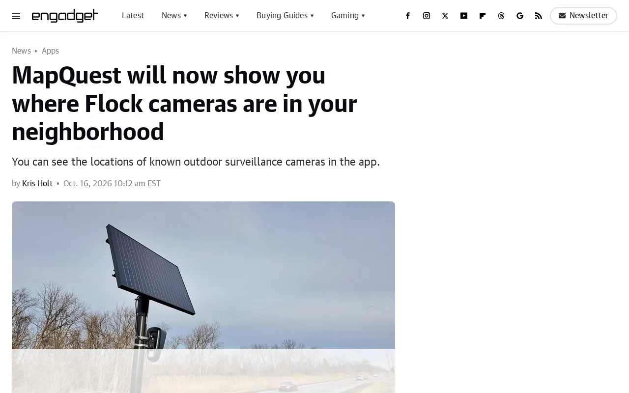
MapQuest has done something few map products do: it has taken surveillance device locations that were once hidden in city management backends and laid them out directly in front of ordinary users. According to Engadget, MapQuest now marks the locations of Flock safety cameras on community maps, so users can see the distribution of these devices when planning routes or viewing neighborhoods. The news received 218 points and 31 comments on Hacker News. The discussion was not especially heated, but opinions were clearly divided—some applauded, others worried.
The event itself: a new "camera layer" on the map
Flock is a security company focused on license plate recognition (ALPR). Its cameras are widely deployed at community entrances, intersections, and around residential areas to record the license plate information of passing vehicles. In the past, the location information of these devices was usually visible only to buyers (such as property managers, police, or municipal departments), and ordinary residents had a hard time knowing how many "eyes" were actually installed at their doorstep.
MapQuest's change brings this kind of information to a consumer-grade map product. Users no longer need to dig through municipal public records or community notices; they can open the map and see camera points. From a product logic perspective, this is equivalent to adding a "security facility layer" to the map, similar in approach to earlier labels for charging stations and speed cameras—except the data involved is more sensitive.
ALPR (automated license plate recognition) technology is the key background for understanding this event. ALPR systems use cameras to capture vehicle images, then use optical character recognition algorithms to extract license plate numbers, and combine them with time and location information to generate structured records. These systems were initially mostly used for highway tolling, parking lot management, and law enforcement pursuit, but in recent years, as hardware costs have fallen, they have been deployed in large numbers on community roads and at residential entrances. Flock Safety is one of the representative vendors in this field, and its business model is mainly "device as a service": communities or property managers pay monthly, the data collected by the devices is stored on the vendor's cloud platform, and shared with police according to agreement. For this reason, the physical distribution of cameras, data flows, and retention periods are often determined by procurement contracts. Ordinary residents can neither see the device list nor easily know how long their driving records are stored or who can retrieve them. What MapQuest's disclosure of location information touches is precisely this asymmetric structure of "deployment visible, data invisible."
Why this is controversial
The reasons of both supporters and opponents of disclosing camera locations are straightforward.
Supporters argue that residents have the right to know which devices are recording them in their community. Once license plate recognition data is misused or leaked, it affects everyone who drives past. Transparency at least gives the public a basis for awareness. In the Hacker News comment section, some users pointed out that many communities did not fully inform residents when installing Flock cameras, and MapQuest's move partly remedies the information asymmetry.
Opponents focus on a practical problem: disclosing camera locations is equivalent to telling potential wrongdoers where the surveillance blind spots are and where they need to detour. Some commenters worry that such map data will be used to evade surveillance, thereby weakening the security effect. This tension between "transparency vs. security" appears repeatedly in discussions about public surveillance data; MapQuest has simply brought it to a larger audience this time.
Data sources and accuracy remain question marks
In the currently public information, MapQuest has not explained in detail the source and update frequency of the camera data. Does it come from Flock officially, municipal open data, or crowdsourced reports? Different sources mean different accuracy and coverage. If the data is outdated or incomplete, users may misjudge the density of community surveillance. This was also mentioned in the HN discussion, but the original report did not provide a clear answer, and follow-up observation is needed.
The "transparency vs. security" controversy is not a new topic. It already has precedents in the practice of disclosing the locations of surveillance facilities. The disclosure of speed cameras and traffic violation capture points was once thought to reduce speeding, but it also gave rise to evasion patterns of "slowing down near cameras and speeding up afterward." After some U.S. cities disclosed the coverage areas of ShotSpotter gunshot detectors, similar debates also arose. In the security research field, two types of information are usually distinguished: one is the existence of the facility itself, and the other is the facility's real-time status, blind spots, and data interfaces. Disclosure of the former helps public oversight and awareness, while disclosure of the latter may be directly used for evasion. MapQuest currently discloses only static points and does not yet involve real-time data, but the density of points itself can already be used to infer weak coverage areas, which is the core of opponents' concern.
Flock Safety's data governance model is worth adding: the company has long emphasized that its platform by default does not open queries to the public, that data is shared according to agreements between communities and police, and that access audit logs are maintained. But disclosure of device locations is not the same as disclosure of the data itself. If MapQuest obtains points from Flock officially, it may receive a relatively complete deployment list; if it collects them from municipal public records or crowdsourced channels, coverage will vary by region—some cities require security devices to be registered, while others have no registration system at all. This fragmentation of data sources means that the density of camera labels in different areas on the same map may reflect "registration transparency" rather than "actual deployment density." Users need to be especially cautious when using it to judge the intensity of community surveillance.
Impact on the industry: competition over the "public data layer" of map products
MapQuest's move essentially opens a new differentiation direction for map products: not just navigation and place search, but also aggregation and visualization of public information. Google Maps and Apple Maps have previously had similar practices with layers for speed cameras and traffic incidents, but when it comes to disclosing the locations of security devices such as license plate recognition cameras, MapQuest is moving ahead.
Behind this is a larger trend—the deployment density of community security devices is rising, and the public's perception of and questions about "being recorded" are growing in parallel. As the most everyday entry point for location information, maps naturally become the place where this tension plays out. If MapQuest's approach proves viable, there is a considerable chance other map products will follow; conversely, if it triggers a backlash over privacy or security, it may also prompt the industry to reassess the boundaries of disclosure.
How ordinary users should view it
For users living in communities where Flock cameras are deployed, this feature provides an intuitive verification tool: open the map, see how many devices are actually around your home, and compare that with what the community previously disclosed to judge whether the information is symmetric. For users not directly affected, the value of this event lies more in a reminder—surveillance devices are entering daily life in a productized way, and discussion around the right to know, data governance, and security boundaries has only just begun.
MapQuest currently only marks locations and does not provide deeper information such as device models, operators, or data purposes. The next step in transparency may not just be "knowing where they are," but "knowing who is using them and what for."
One-line Summary
MapQuest discloses the locations of community Flock license plate recognition cameras, sparking debate over transparency and security.
Paragraph Summary
MapQuest marks the locations of Flock license plate recognition cameras on consumer maps, allowing residents to see the distribution of community surveillance devices without digging through municipal records. Supporters believe this remedies insufficient installation notices and protects residents' right to know; opponents worry that publicizing the points will be used to evade surveillance and weaken security. The report also notes that the source and update frequency of the camera data are not yet clear, accuracy is questionable, and users may misjudge surveillance density. The article sees this move as a signal that map products are extending from navigation tools to public data aggregation layers, and notes that discussion around the right to know about surveillance devices, data governance, and security boundaries is still in its early stages.
Related articles
AWS AgentCore Gateway: Connecting AI A…
AWS AgentCore Gateway: Connecting AI Agents to Enterprise Backends with MCP
How AWS AgentCore Gateway acts as a primary MCP server to aggregate REST APIs, Lambda, and existing MCP services? Analyzing its AST real-time mapping, zero cold start, semantic search for tool overload, session isolation, and key injection security design, plus the architectural approach to decoupling enterprise AI agents from backends.

One Link Gives Figma AI a New Skill: Hands-On with MCP Connectors
Paste one MCP server link and the AI Agent in Figma gains new tool capabilities. We break down the setup flow, 20+ one-click apps, read/write permissions and execution policies, and the public HTTPS requirement.

Cognition SWE-2 in Practice: One Prompt to Handle the Whole Product Launch Process
Analyzing a YouTube creator's prompt for using Cognition SWE-2 to launch a product: a landing page, seven-email sequence, and non-buyer follow-up tool, plus how the 'test and report' constraint changes AI delivery quality.